Los Dientes de Navarino
Spoiler alert: this is going to be a long post.
When I was in Buenos Aires, I met a group of French guys who told me about a small island south of Ushuaïa, where there is a trek that you can do in 4-5 days: Los Dientes de Navarino.
I originally planned to stay 2 weeks in Ushuaïa, having some friends joining me for New Years there. But after discussing with a few people, I was convinced to go to Isla Navarino, south of Ushuaïa, to check out if there were interesting walks or treks to do.
I spent 2 days in Ushuaïa (an article about it will follow) and eventually took a boat to Puerto Williams on Isla Navarino. I went there kind of unprepaired, I knew that the Dientes circuit was a difficult trek, not always well indicated, I didn’t have any map, camping gear or food, so I really arrived there like a tourist 🙂 Although a lot of people motivated me to do this trek, I knew that I would never do it alone, it would be too risky. After checking out the area I thought about abandonning the idea and do day hikes in the region. But just when I thought that, I met a couple who wanted to leave the day after for the trek and offered me to join them! They were fully prepared, maps, gps, camping gear, food, everything! That was like a christmas gift for me 🙂 After renting the last missing pieces of gear, we were ready to go!
Los Dientes de Navarino is 54 km trek that you normally do in 5 days. We did a slightly longer path, around 60-65 km by going to Lago Windhond, and did it in 4 days.
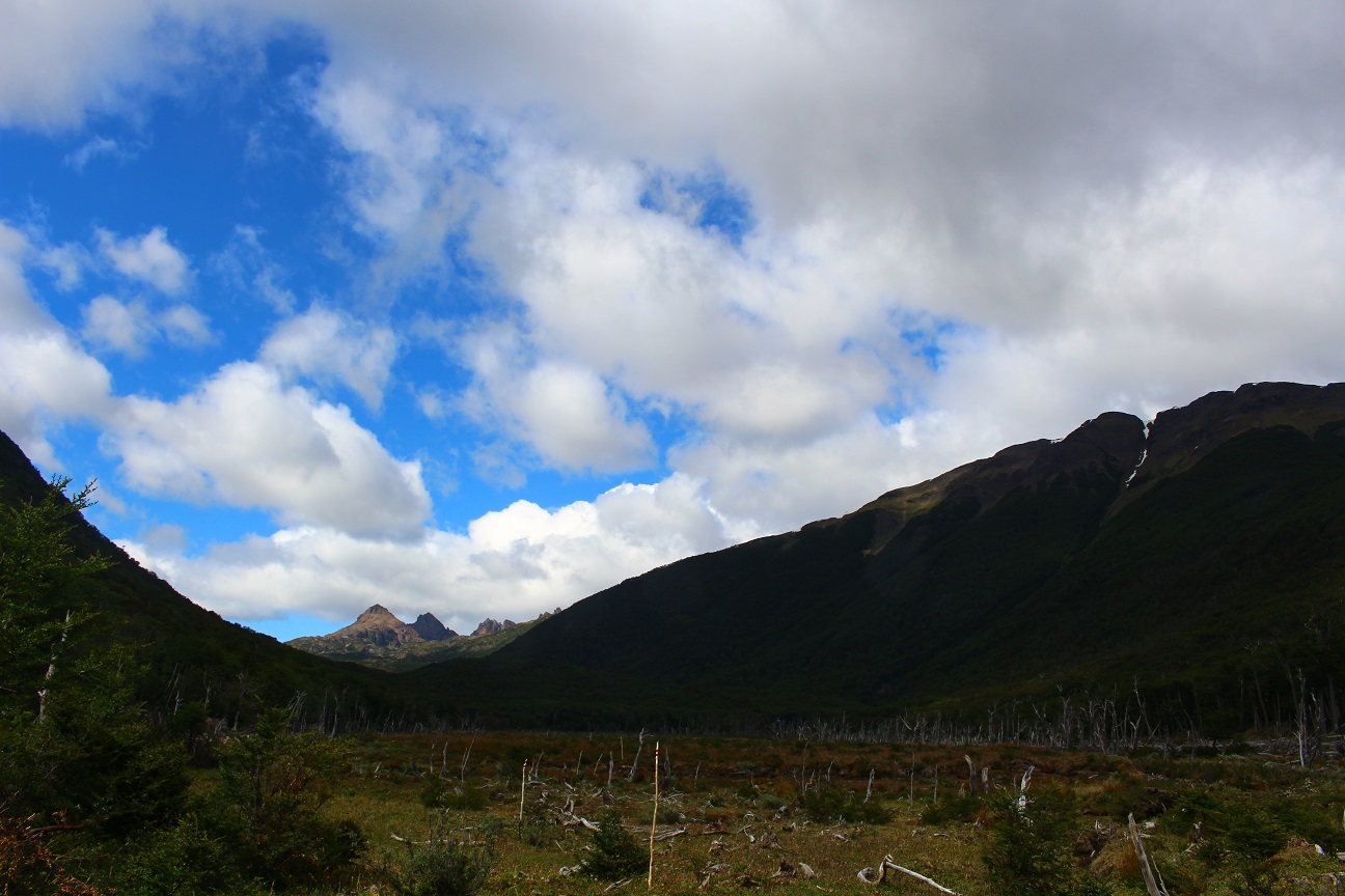
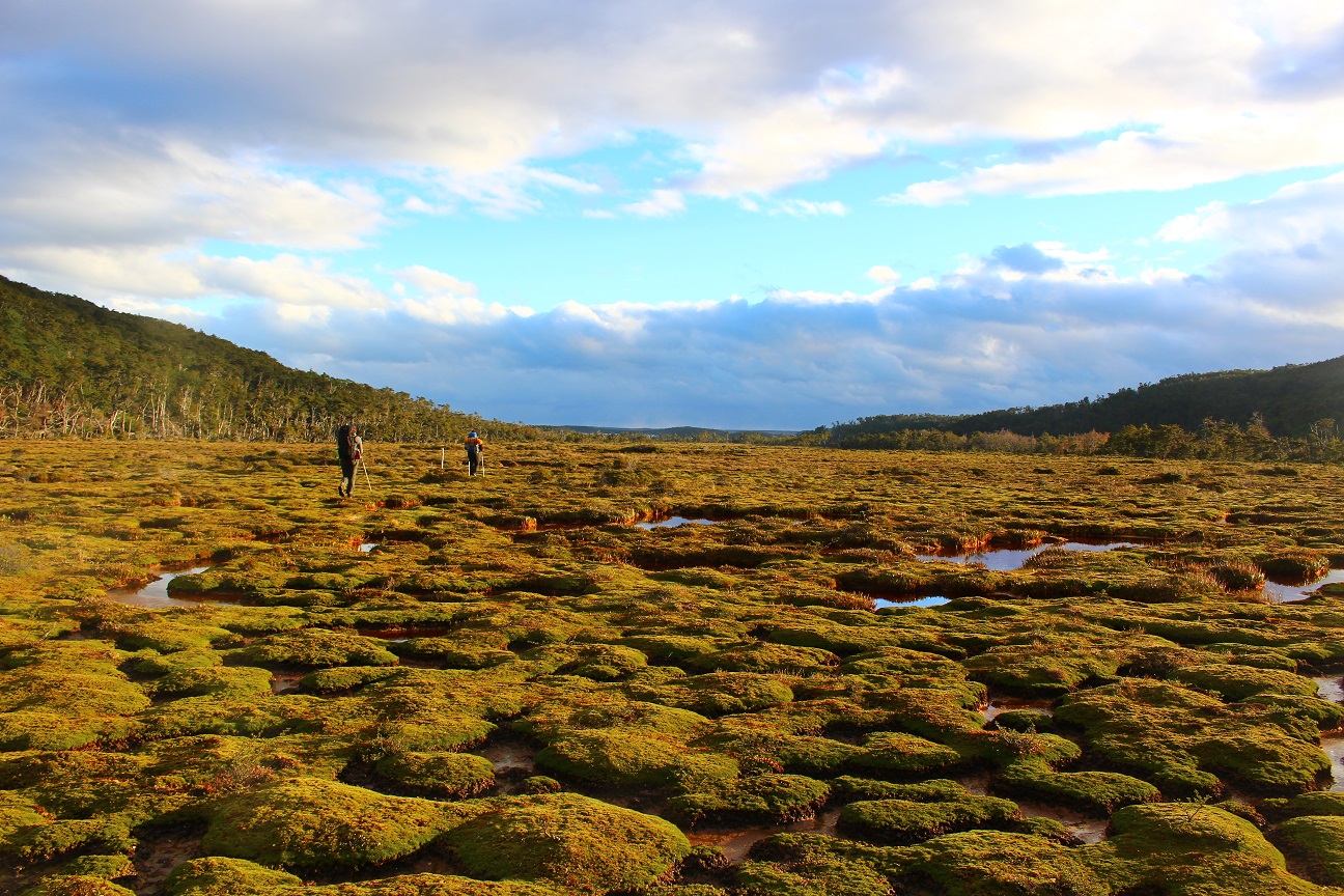
On the first day we left Puerto Williams to go to Lago Windhond, our first stop. It’s a 24 km walk, through forests, lowland, swamp, rivers, mountains and beaver dams. It was quite exhausting, although it was the first day and we were full of energy, our backpacks were also full of food, and since this part of the trek is not as famous as the rest, the trail was not as clearly marked and we got “lost” a few times. It started easily, walking through a forest, it got a bit more complicated when walking through a swamp where you have to carefully think about where to step to avoid ending up soaked…
The first time you step in 5 cm of mud you’re like “Oh nooooo”, and then when you step in 10 cm of mud you think “Ok, 5 cm of mud I can take it!”. Then we had to walk through another forest, full of fallen trees, where we had to step over or walk under them… There it was a bit tough to follow the trail, and we were like
– “Do you see a mark?”
– “No”
– “Do you see a path or something similar?”
– “No”
– “Then do you see a footprint in the mud?”
And we eventually got back on track 🙂
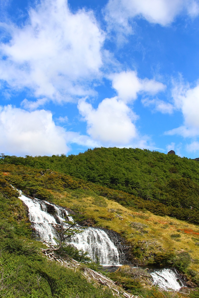
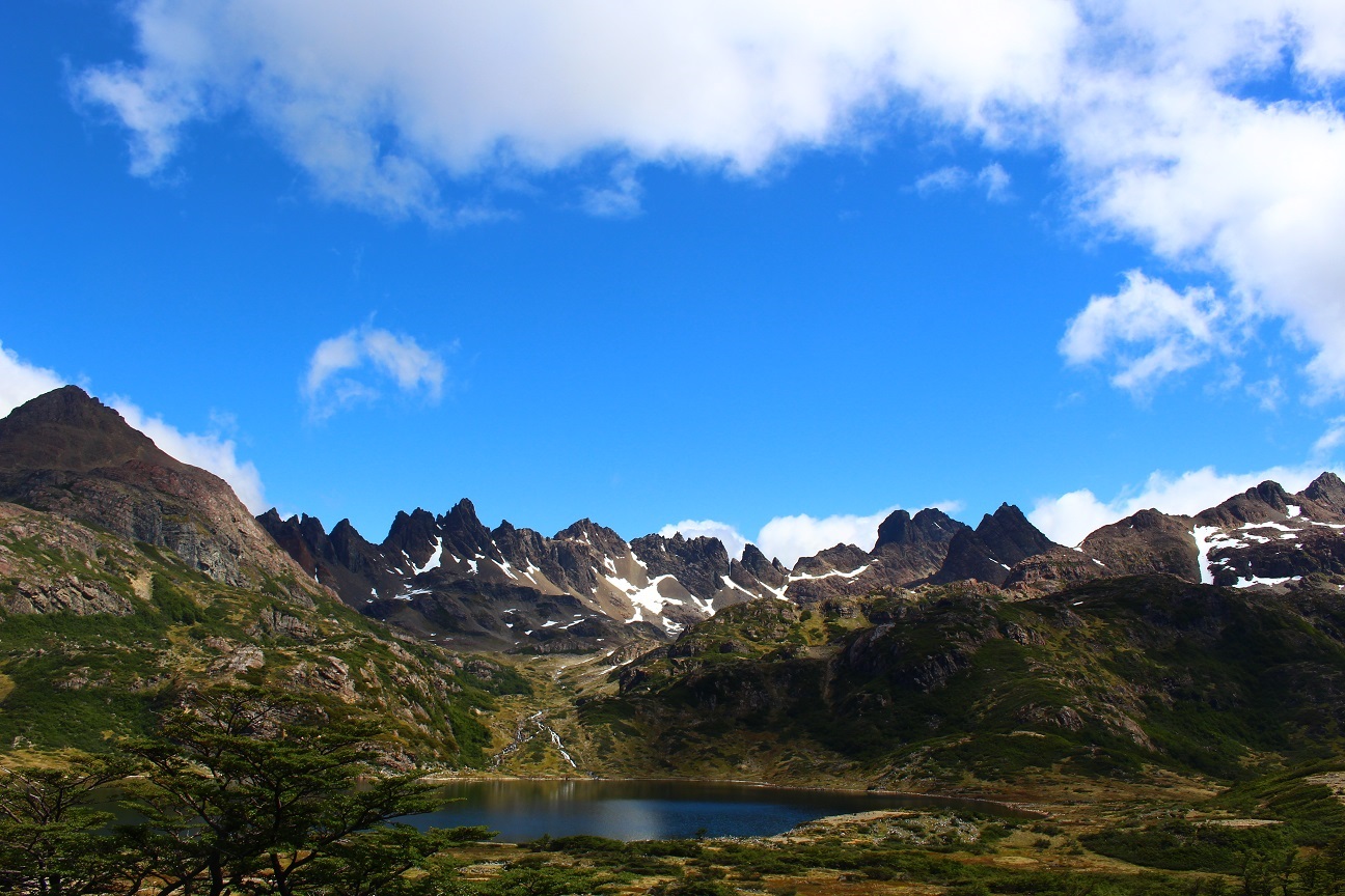
Through all this walk we saw amazing views, lakes, waterfalls, mountains, lowlands, it was really spectacular! And we really did have all seasons in the same day: a bit of sun, a bit of clouds, rain, snow, hail, all at the same time! And wind, always wind!
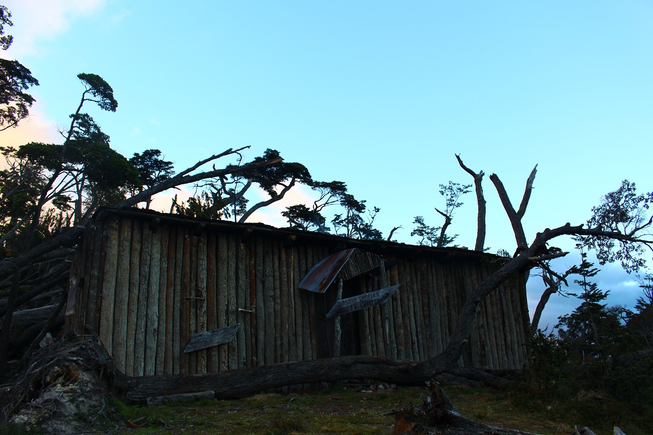
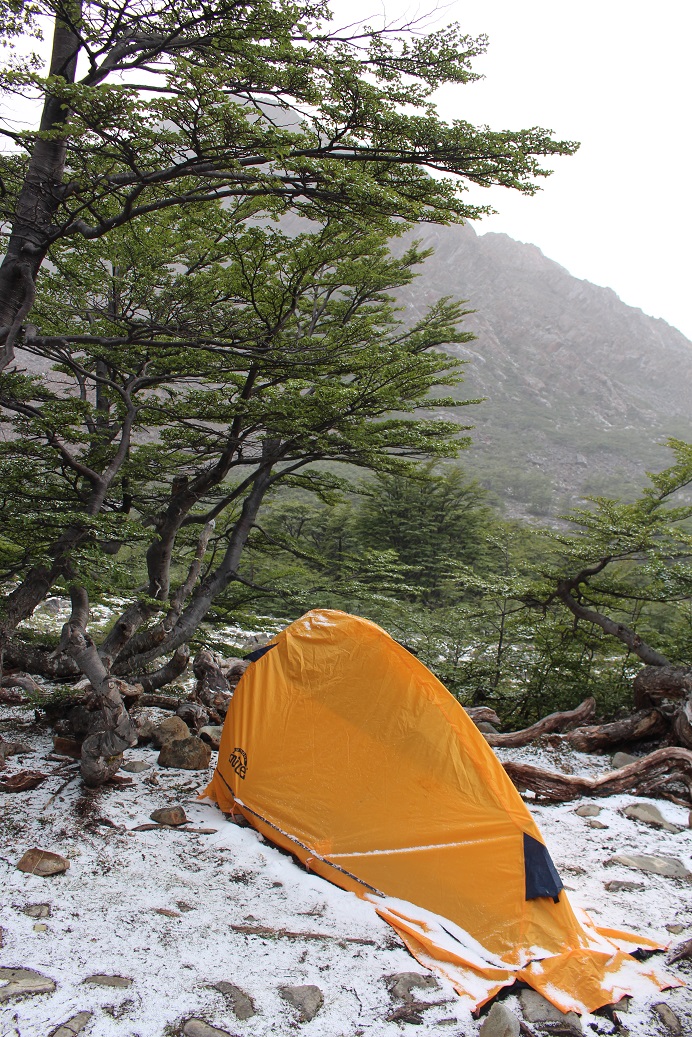
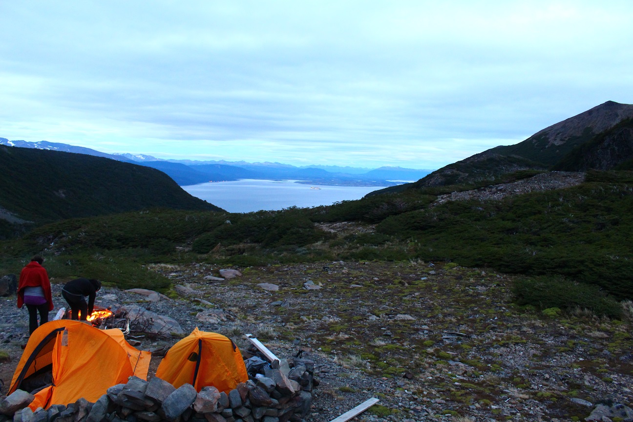
It eventually took us around 12 hours to reach the shelter, because luckily our first stop was at a shelter next to the lake! The good part about doing trek in the South in summer is that there is light almost all the time :)We arrived at the shelter around 9:30 pm and it was still daylight! And the even more amazing thing is that we didn’t need to set our tents or start a fire, as we could sleep within the shelter, on foam mattress, where there was already a stove 🙂 Better than a 5 star hotel! And this is where we spent Christmas Eve 🙂
On the second day we left Lago Windhond, the shelter and its comfort to get back on the official circuit.
It was a bit easier, because as the days passed our backpacks got lighter. We started walking on lowlands, then through a forest to later go through a pass. When we got closer to the pass it started snowing, with quite a lot of wind and the visibility reduced.
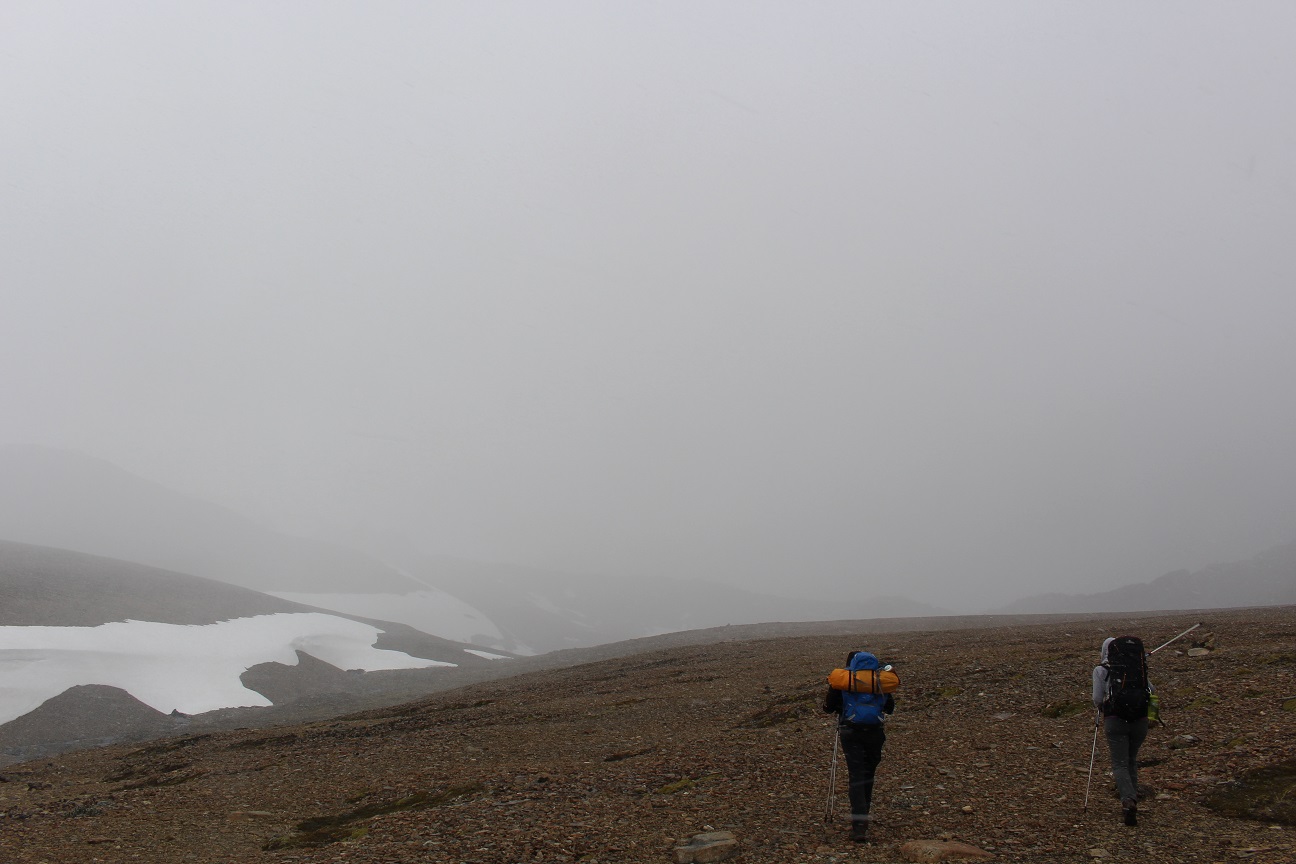
Thankfully by the time we arrived at the ridge the snow stopped and the weather got clearer. But we still had to walk carefully as the ridge was quite steep and strong gusts of wind made us unstable.
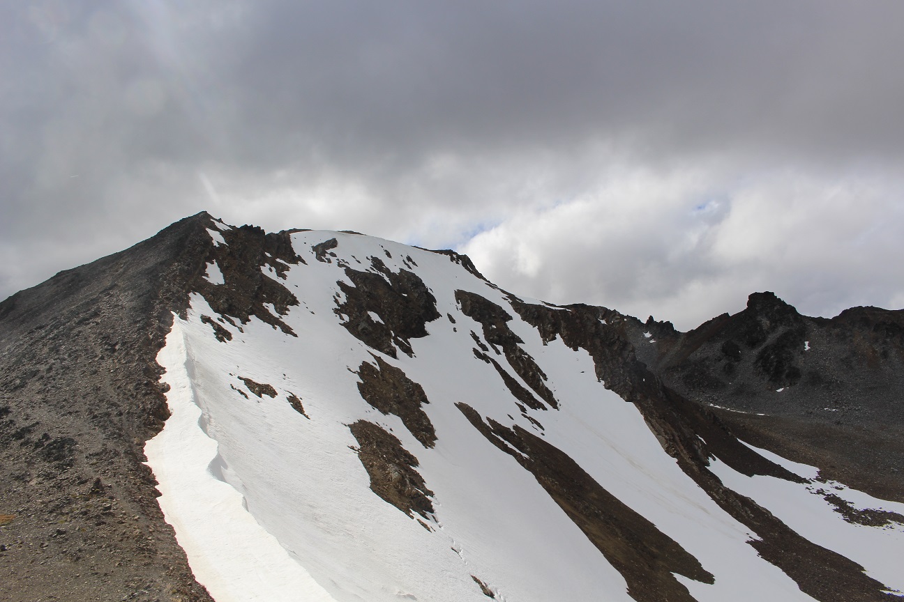
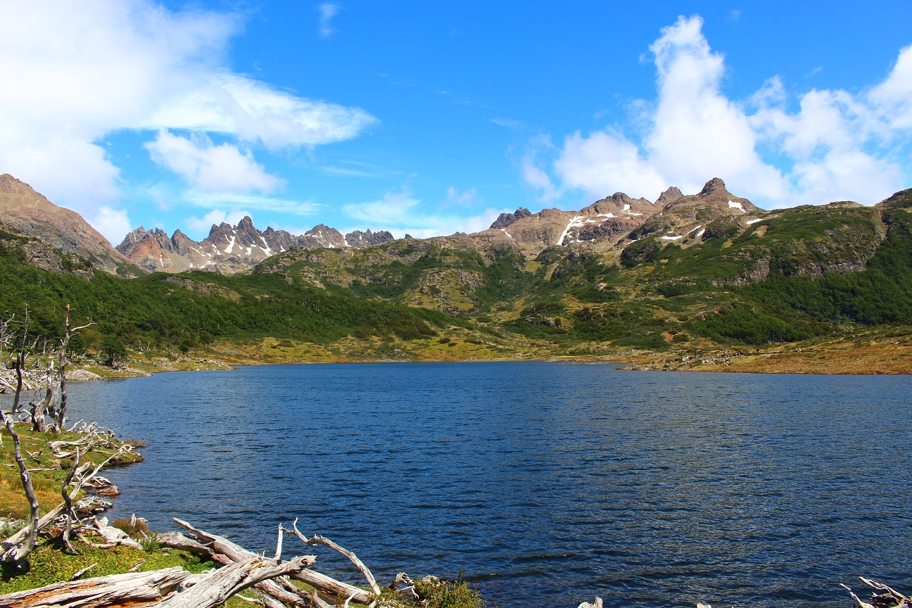
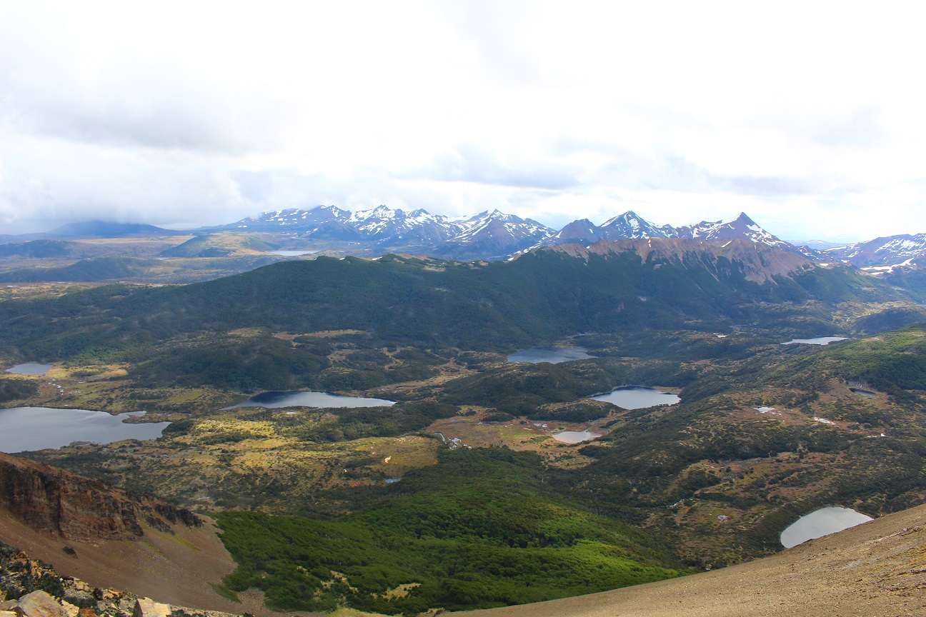
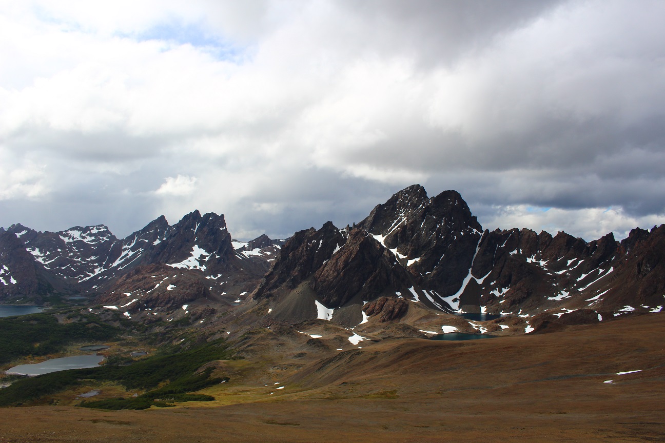
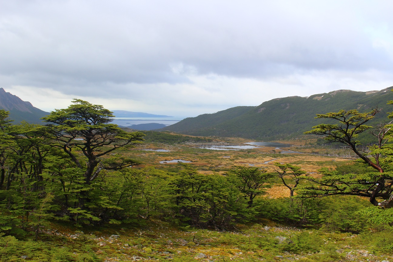
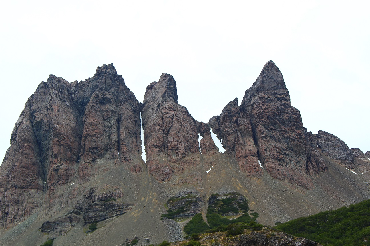
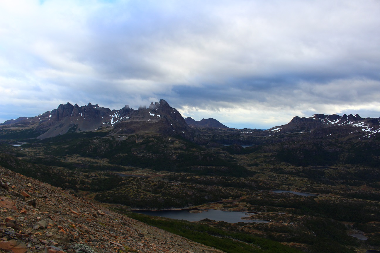
When we reached the top we had an amazing view on the lowlands, the lakes and the Dientes! It looked like we were at the top of the world!
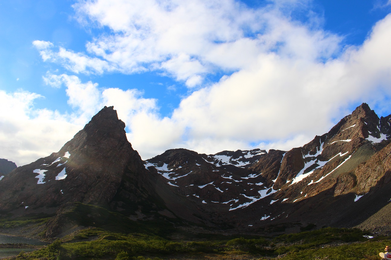
Going down from the top, we eventually joined the official circuit, where the marks are easier to follow. After walking for a few more kilometers, we decided to set camp next to a lake. We can normally set camp anywhere we want, wild camping is authorized, but there are some dedicated places on the circuit, protected from the wind, with a fireplace and next to a water source.
The cool thing is that the water from the rivers and lakes is drinkable, no need to even filter or treat it! That night it got colder and it actually snowed! On that day we walked around 15 km.
On the third day we woke up with a bit of snow on our tents.
The weather was unstable so after a quick breakfast we started walking. It was colder than the days before, and quickly it started to rain and snow. Walking through the bushes when it rains you actually get soaked quite quickly! But thankfully the weather changes quickly as well, and got a bit better later.
We knew that we needed to go through a pass at the end of that day, right before reaching our camping spot, so we rushed a bit more as we didn’t want to take the risk to go through the pass with bad weather. Fortunately the weather got more stable and we were able to keep going. Before reaching the path we had to go through a steep forest, totally muddy and slippery, thankfully it was not raining at that time because otherwise it would have been way harder!
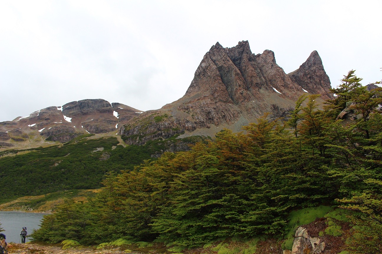
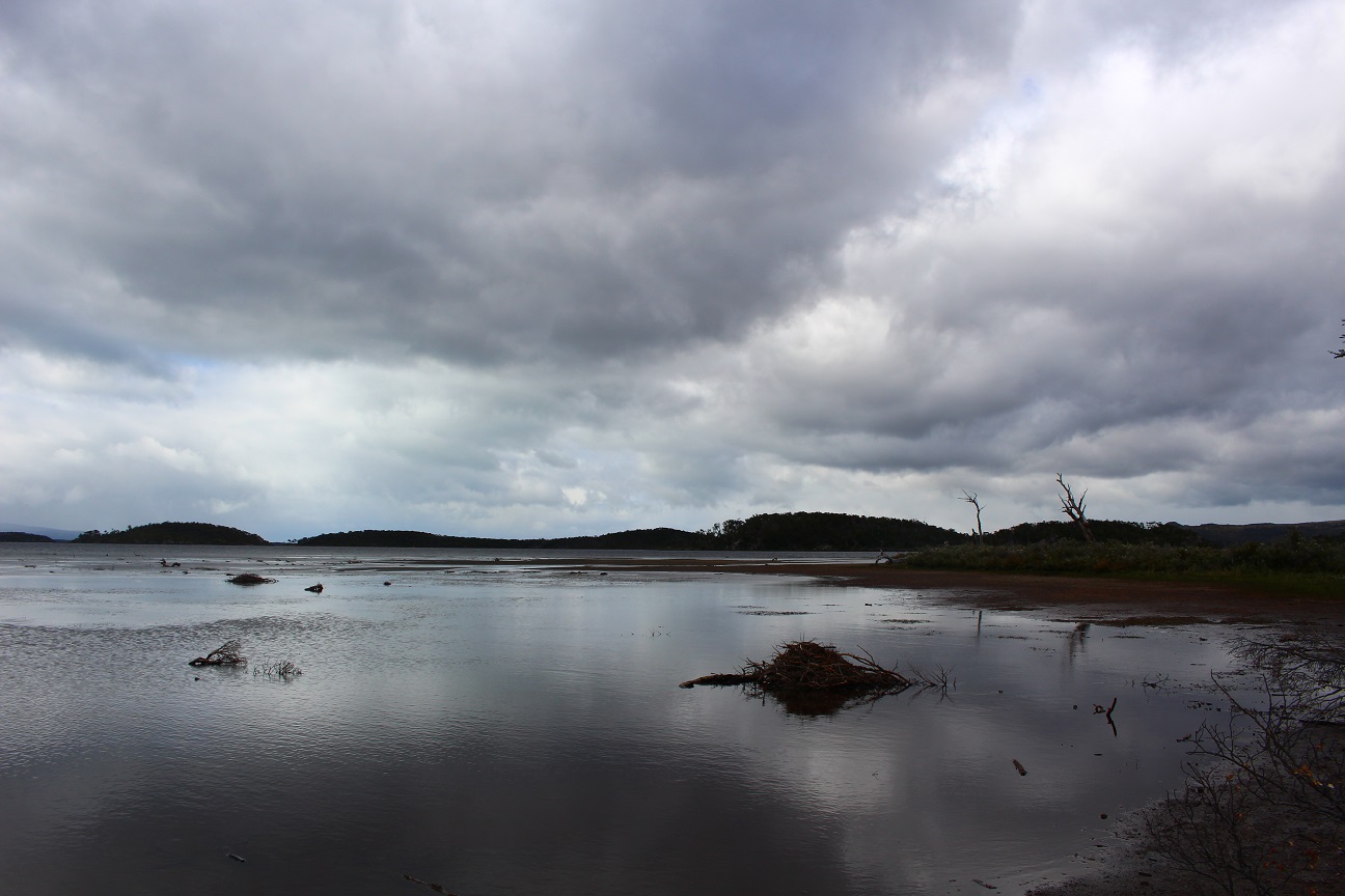
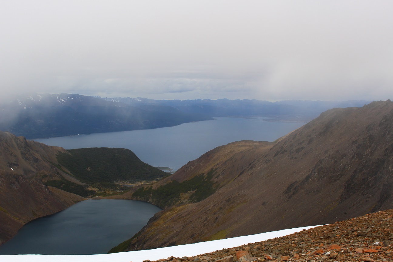
At the top of the pass we had an amazing view on a lake and on the Beagle Chanel! After reaching the ridge we had to go down on the other side of the pass, through gravel and stones, that was quite difficult… And we eventually reached our last camping spot, next to the lake, after having walked around 16 km.
Our last day was a short day, as we were missing around 6 km to get out of the circuit, going down through a forest to eventually reach the road to Puerto Williams, where we had to walk 6 more kilometers. The weather was with us as for once we didn’t even have rain nor snow, and even had to get protection from the sun from time to time! Even though our backpacks were quite empty (almost no food left), our legs were tired from the 3 previous days of walking, and we were happy to our hostel in Puerto Williams 🙂
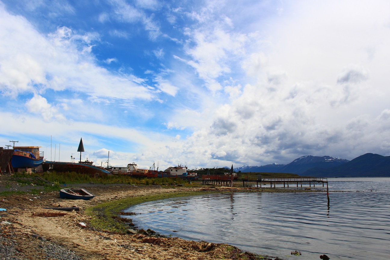
Puerto Williams is a really cool place, small, quiet, peaceful. It’s difficult to reach so people who get there are mostly nature lovers, hikers or sailors who want to go around Cape Horn 🙂
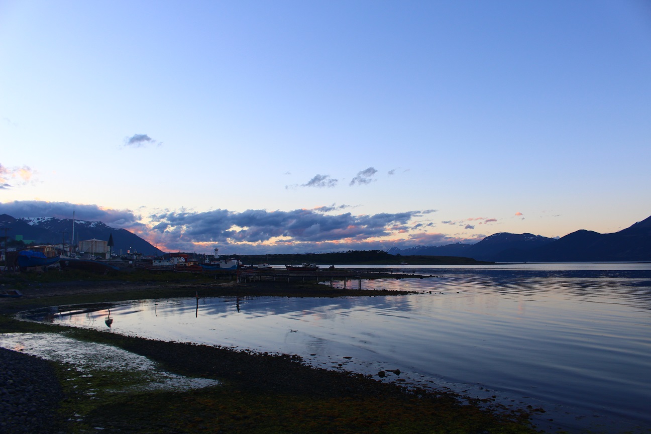
I spent one more day there to relax before going back to Ushuaïa. More on this in a later post!
6 thoughts on “Los Dientes de Navarino”
Excellent Fréd, quelle découverte, bravo pour l’endurance. Noël : Jésus est aussi né dans une cabane 😅😅. Super 😘😘 et merci de ns faire voyager avec toi.
Très joli tour et très intéressant rapport de course, merci et bravo pour le tout!!
Magnifiques images et souvenirs pour toi. Merci de les partager avec nous.
Belle suite d’aventure!!
Pap.
Dear Fred
It’s a very nice and interessting report! I am curious about how it’s going on.
All the best on your trip.
Willi T
Justo venimos de descubrir tu blog, del cual tus papas nos han hablado con estrellitas en los ojos ✨ Gracias por permitirnos viajar un poquito contigo en ese magnifico continente ! Estamos tan felices que realises este camino de vida 💗 Bravo y que la Fuerza este contigo 😊
Quelle belle aventure et Noël magique! C’est un plaisir de te lire merci encore pour le partage 🙂 profite!
Man,
This is aweeeeesome :D:D:D:D
Keep it up 🙂
Matt