Salkantay Trek to Machu Picchu
The Salkantay Trek is a 4 days trek through mountains and jungle to reach the Machu Picchu, that can be visited the 5th day. It’s named after a 6271m high mountain, the Salkantay, which means “The Wild, Invincible Mountain” in Quechua.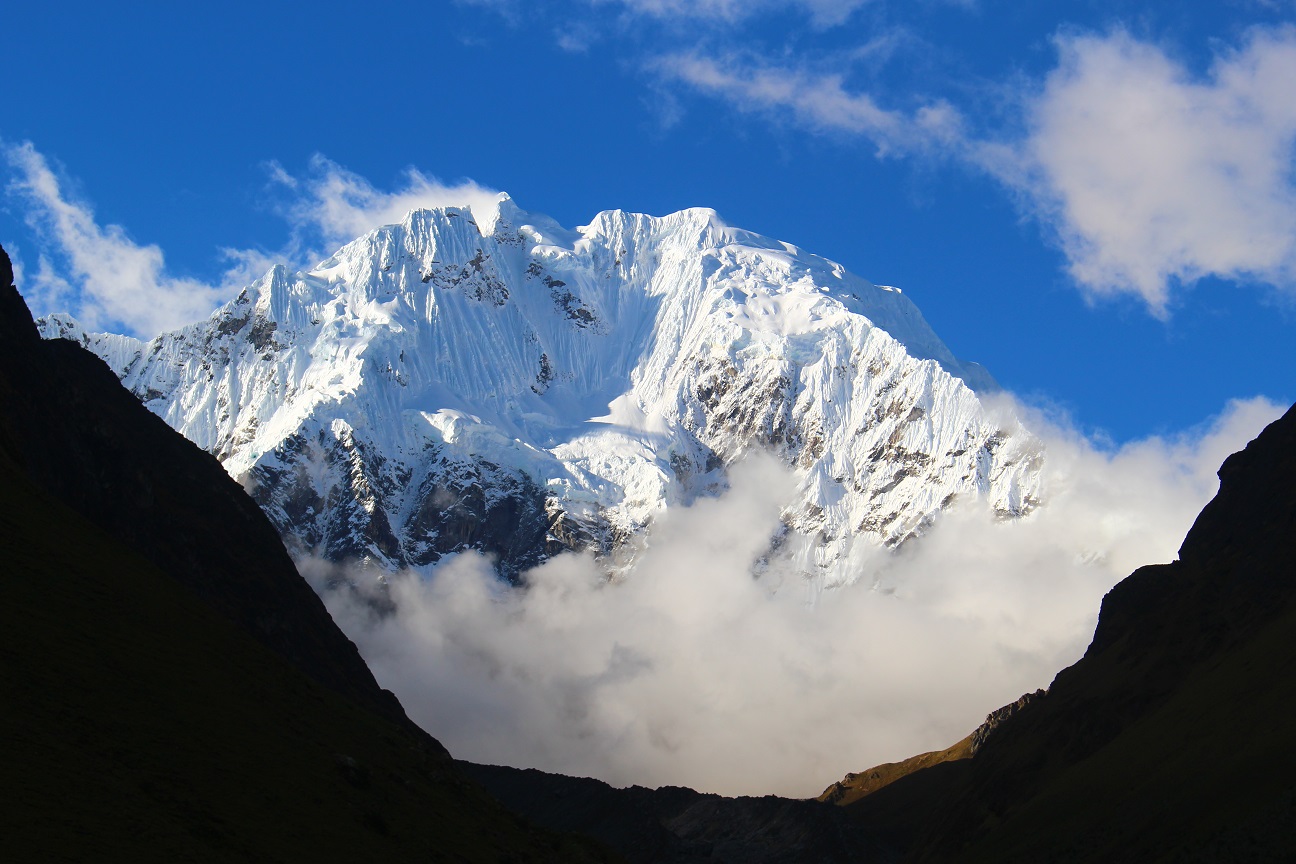
Although it’s a trek, this path is really touristy and “luxury”, in a sense that you don’t have to carry all your stuff, there are mules that do it for you, and within the group there is a cook who takes care of the food 🙂 So all you need is a day pack and some resistance to the altitude! I registered to do this trek with an agency, and ended up being alone with the guide, so I had a private tour 🙂
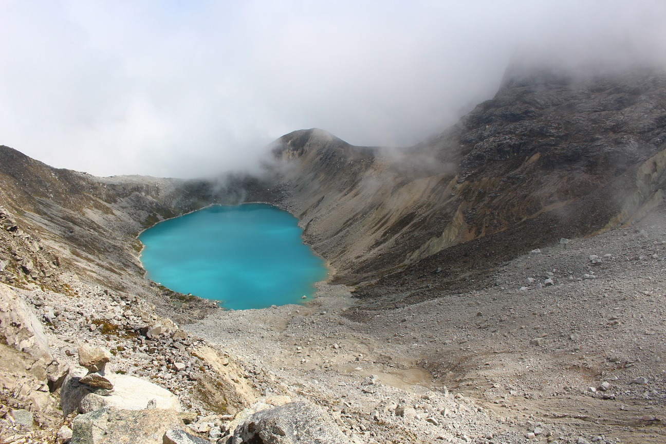
The trek started on monday, the agency came to pick me up at 5 am, we drove around 2 hours to a village at 3600m, and after breakfast we started to walk. We walked around 2 hours to the first camping spot, at 3900m, where we rested a bit and had lunch. After that we walked up to the Humantay Lake at 4300m, the water was turquoise, with nice reflection! It’s right behind the Humantay mountains (at 5400m), that means “Head of the Gods”, with a glacier that feeds the lagoon.
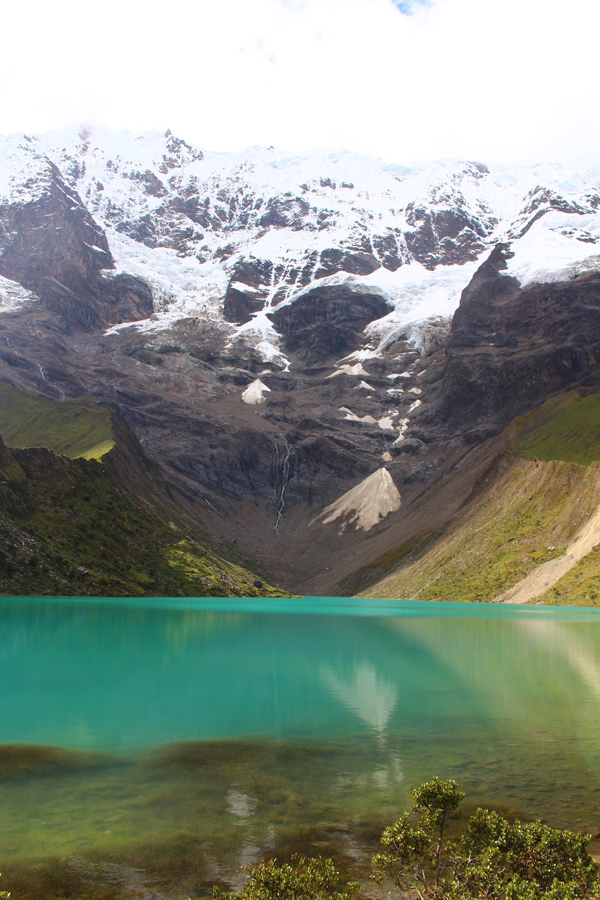
I learnt from my guide that this place was used for ceremonies by the Incas, they worshipped the mountains, especially those with glaciers that had lagoons as water is the symbol of life. Basically every big mountain with a glacier and a lagoon is called “Apu” which means “Sacred Mountain”. So it would be Apu Humantay and Apu Salkantay.
After enjoying the view we went down to the camping spot and rested for the rest of the day. Overall it was quite a short day, not so much to walk (around 11km), although the altitude didn’t help 🙂 The first night of camping at 3900m was quite cold, but the sky was amazing with millions of stars 🙂
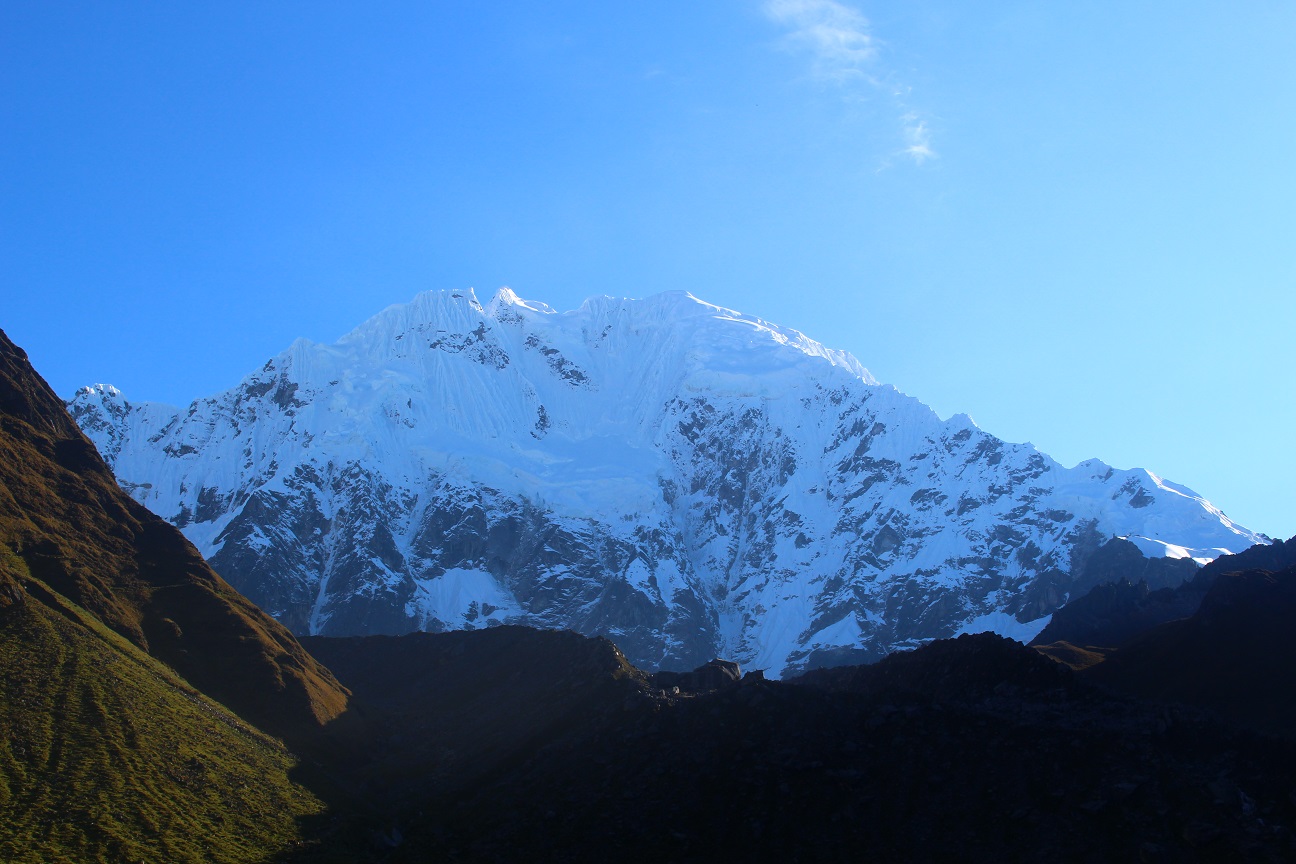
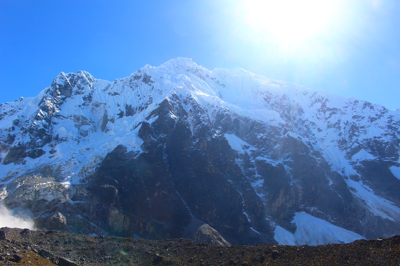
On the second day we started walking at 6:30 am, before the sunrise it was quite cold, but thankfully afterwards the sun came out. The second day was quite long as we had to walk up the Salkantay pass at 4600m where we had an amazing view on the mountain! It was really impressive, being at right below this monster mountain at more than 6000m! Unfortunately as we reached the pass, the clouds came out and hid the Salkantay. Still we went to see its lagoon, and later on the sky cleared again 🙂
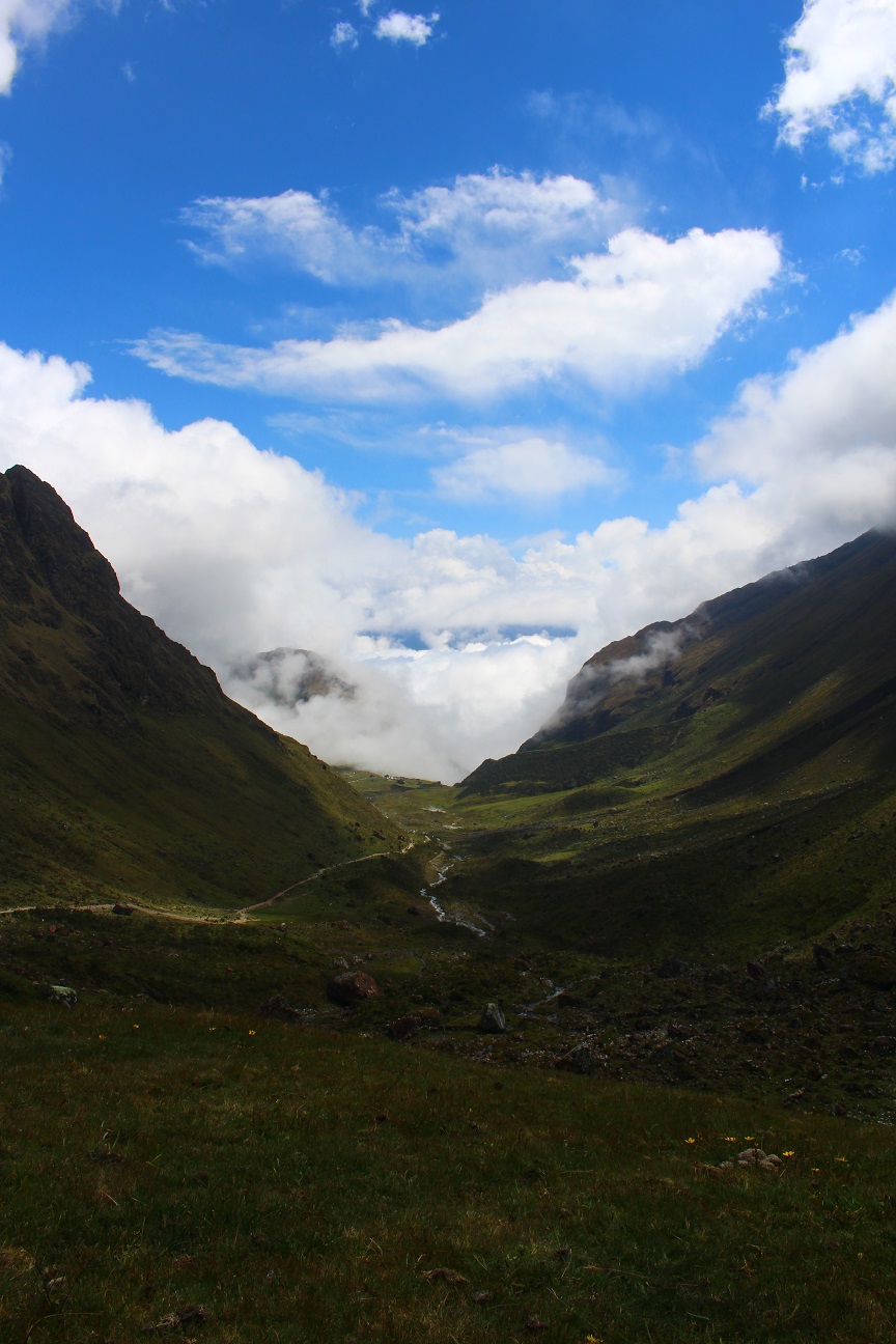
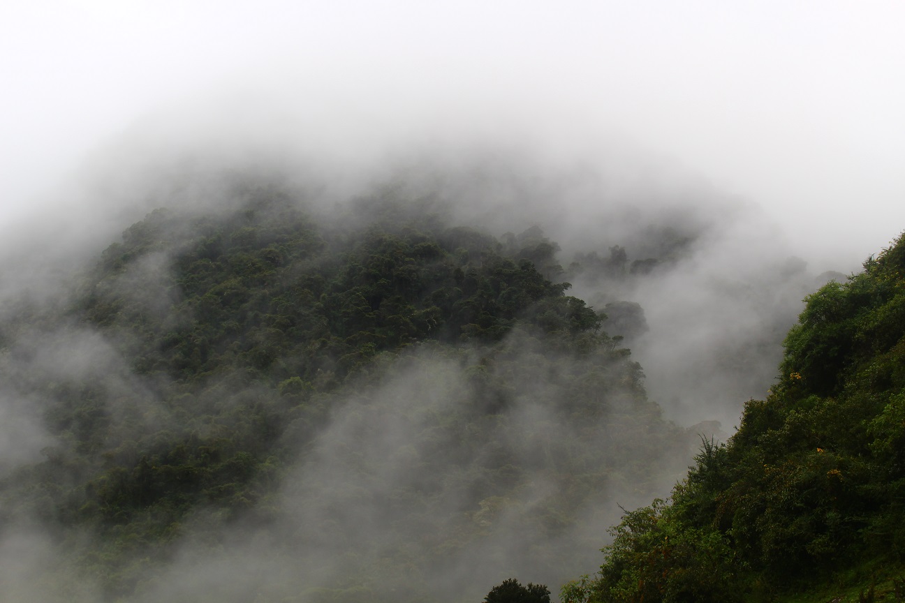
We continued walking down, on the other side of the pass. Our next camping point was at 2900m, so we had to walk 1700m down! It was quite funny to see how the landscapes changed, from rock and dry at the pass, and slowly seeing some grass around, to end up in the jungle 🙂 The weather also changed quite a lot, we left the morning with a blue sky, reached the pass with clouds and ended up in the jungle with fog.
But again, the weather got better in the evening, although it rained during the night we never got wet while walking. It was quite a long day, more than 24km walk, with 700m going up and 1700m going down, a good night’s rest was needed 🙂 On this part of the path, some people were on horses as they couldn’t walk it, and the cooks and the tourist’s stuff where carried by mules.
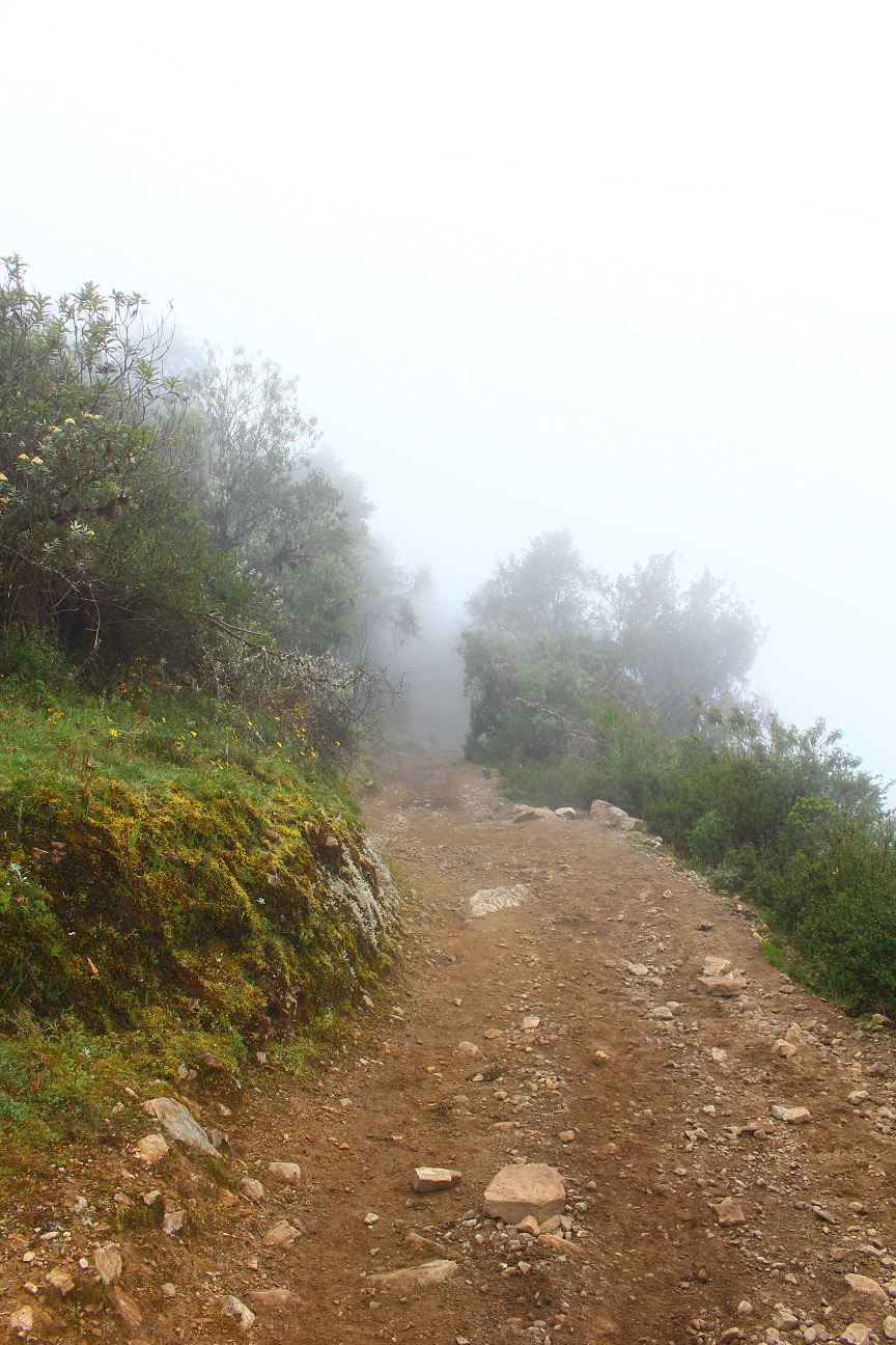
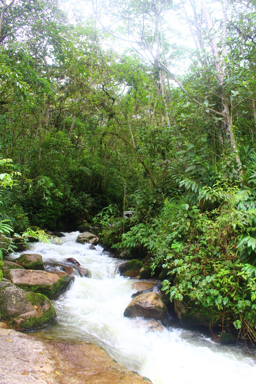
On the third day we walked in jungle-like landscapes, it was cloudy but withou rain, although the path was muddy. From this camping place, there was a road (a dirt road), so the cook went ahead of us in car with our stuff. We walked partially on the road, partially on smaller paths, as due to the rains there had been some landslides making the paths unpracticable.
We walked a bit more than 5 hours in the rain forest, seeing the different plantations that people have there, tropical fruits, corn, avocadoes, etc… We eventually reached the place where we had lunch, at 2100m, after around 17km walking. The place where we stayed was a small village next to coffee plantations.
After lunch we took a car to go to the next camping place called Santa Teresa. I was a bit disapointed, I didn’t expect to take a car during a trek… Moreover my guide was half drunk, so it didn’t really make me happy…
We reached the third camping place in Santa Teresa, at 1600m high. It’s a small town, where a lot of different treks stop there, as the next day is the walk to Aguas Calientes, the Machu Picchu village. The climate there was really tropical, humid and quite warm.
As this was the last camping night, it was quite the party there, although as I was quite tired and a bit disapointed in the day, I didn’t stay long. I think though that my guide got drunker…
The next day we started walking in direction of the Machu Picchu. As I was not happy with my guide and how he behaved, I walked on my own, leaving him a few meters behind.
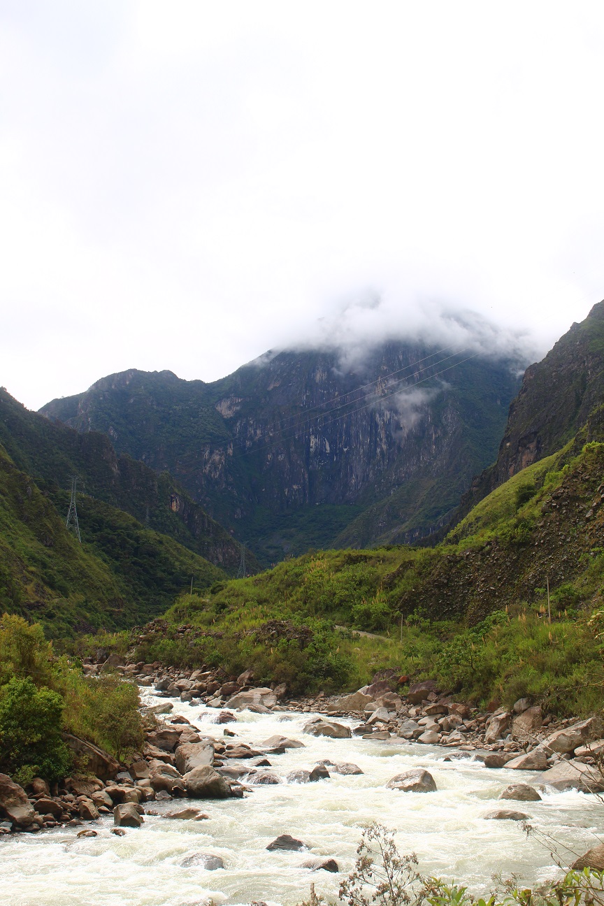
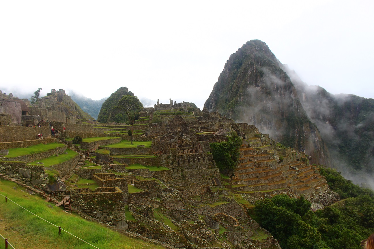
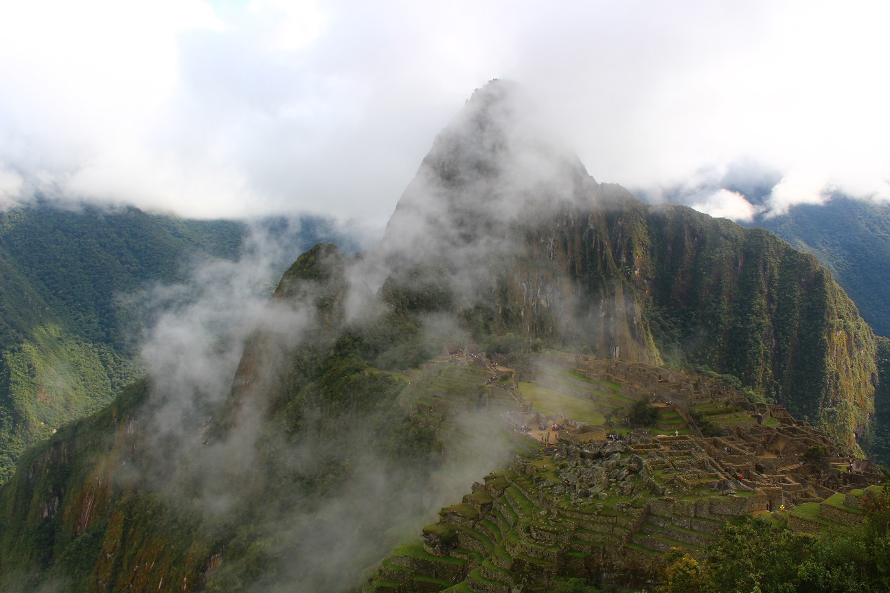
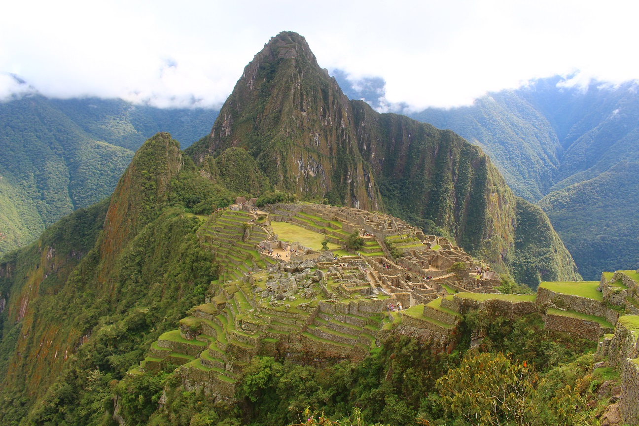
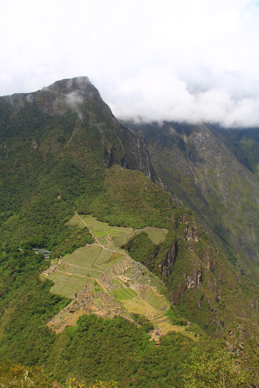
Still I could enjoy the walk, along a river, gradually reaching the Machu Picchu mountains! We were able to see them from below, and even though we could see the Machu Picchu mountain and the Huayna Picchu (the other mountain), the city itself is quite hidden! Seeing this we understand better why they chose this place to build it!
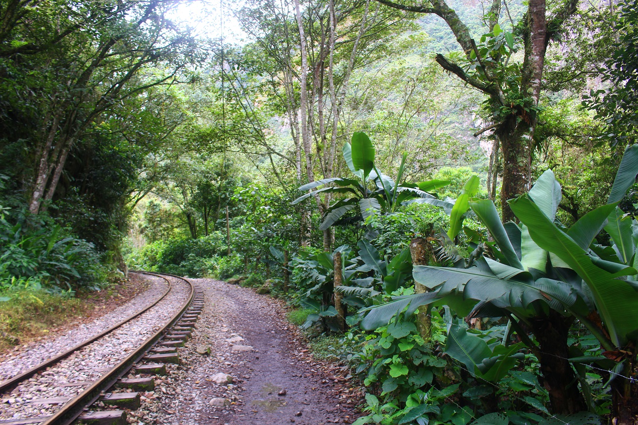
We reached Hidroelectrica, a small village next to a hydroelectric power plant, and from there we walked along the railways until Machu Picchu village. It’s quite funny, the railway is really in the middle of the forest 🙂
We eventually ended up in Machu Picchu village (also called Aguas Calientes) at around 2000m high, after a 19km walk.
Machu Picchu village is really touristy as it’s the starting point to visit Machu Picchu. So we walked a bit around the village, and spent the rest of the day at the hostel, resting, as on the last day we had to wake up quite early to go visit the ruins.
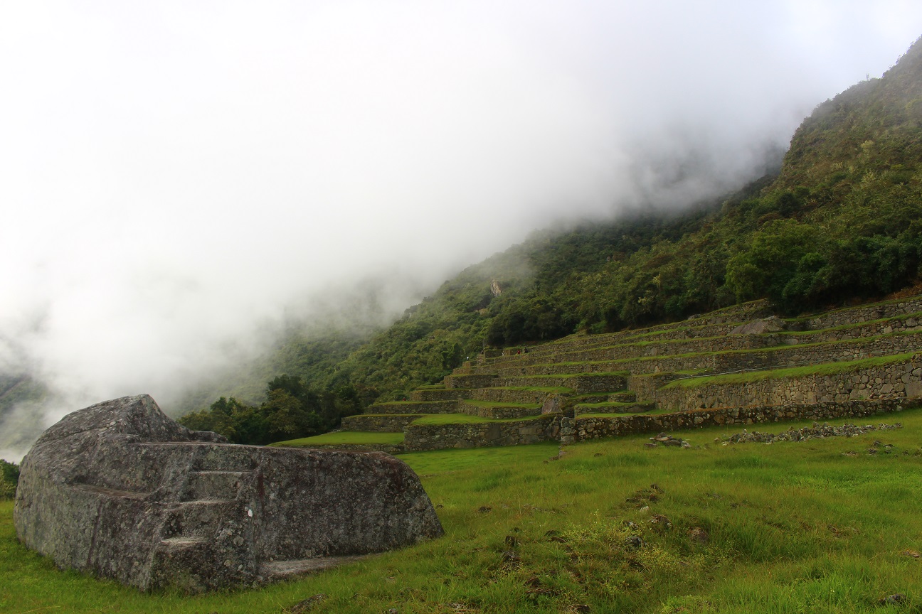
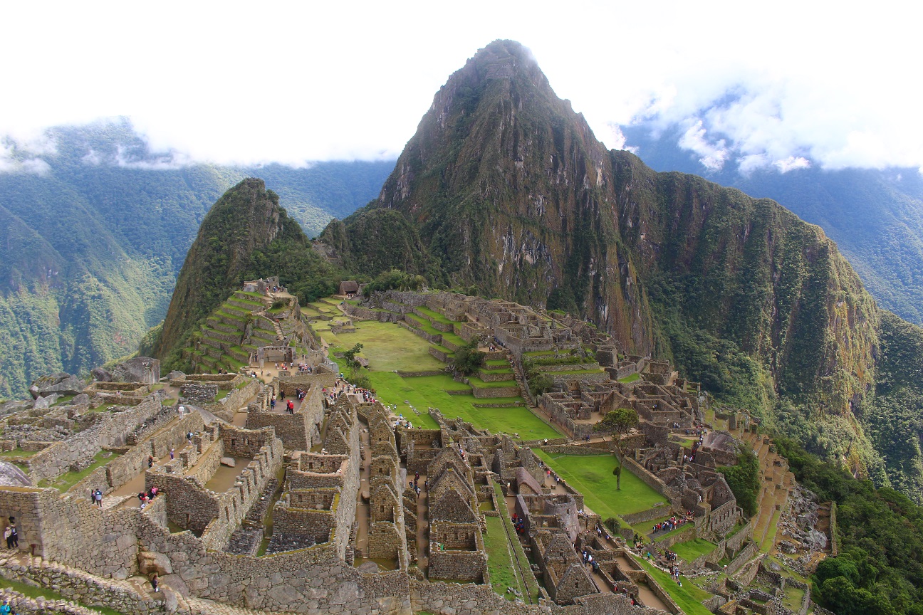
On the last day we wokd up at 4:30am and left at 5am to walk up to Machu Picchu. There are 2 was to go there, taking a bus, or walking. I wanted to finish the trek with my own feet, so we walked until 2400m where the ruins are. There was a huge queue of people waiting for the bus, and a bit fewer people waiting to start walking 🙂
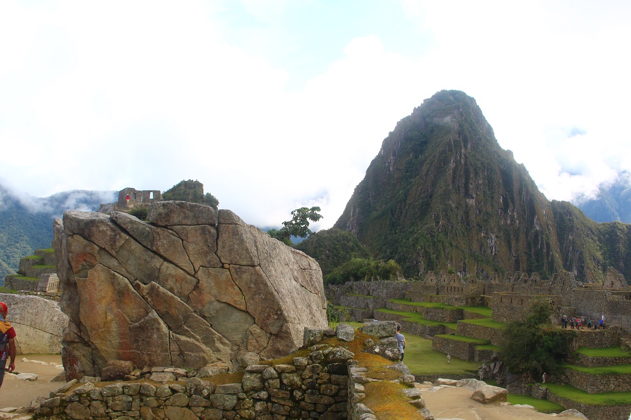
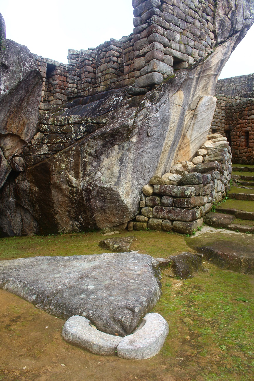
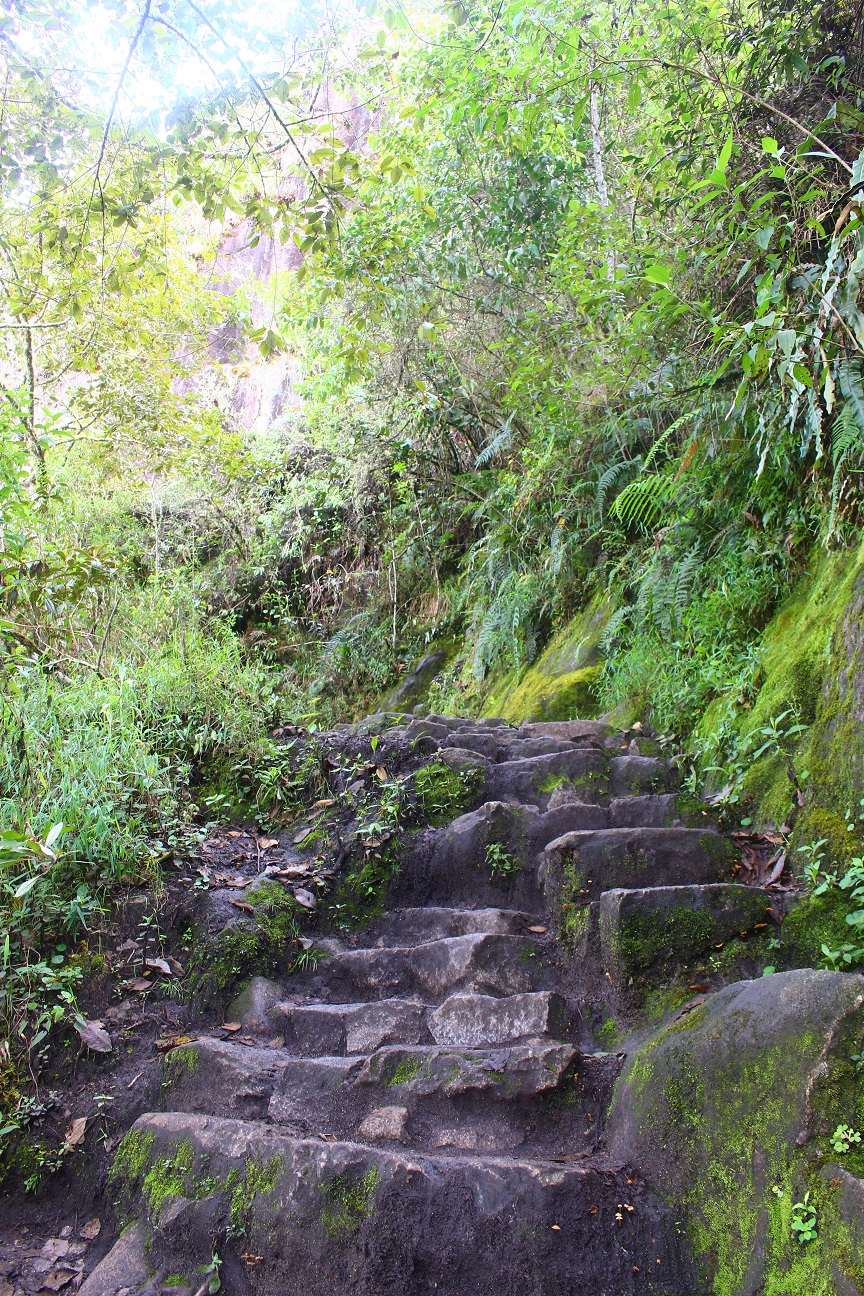
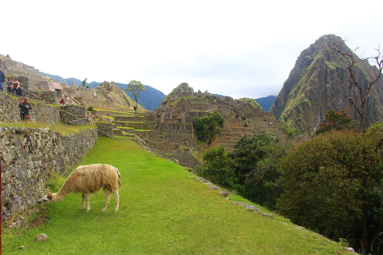
The way up is basically stairs, and it’s really steep… After around 45min we reached the top, already exhausted… After a short break, we entered the site and had a guided visit. It was really interesting again!
Different guide, different theory. The first time we were told that Machu Picchu was a university to educate the sons of the conquered tribes. This time I was told it was a knowledge place, also with a university, but more for sharing the knowledge among the nobles, and a place to test different kinds of agriculture in altitude. I was also told it was the residence of the Inca king, Pachacutec, after his reign.
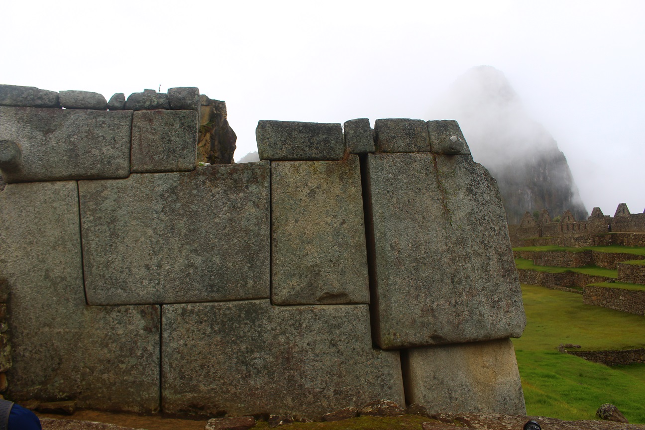
It was really interesting to have these different theories, but one thing is for sure is that we don’t know, it’s not finished 🙂 All documentations were destroyed by the spaniards when they arrived, the place was abandoned before it was discovered, that’s why it’s so well preserved, and we think that the people who lived there moved to the amazon and eventually died there due to diseases.
So the mystery around Machu Picchu remains…
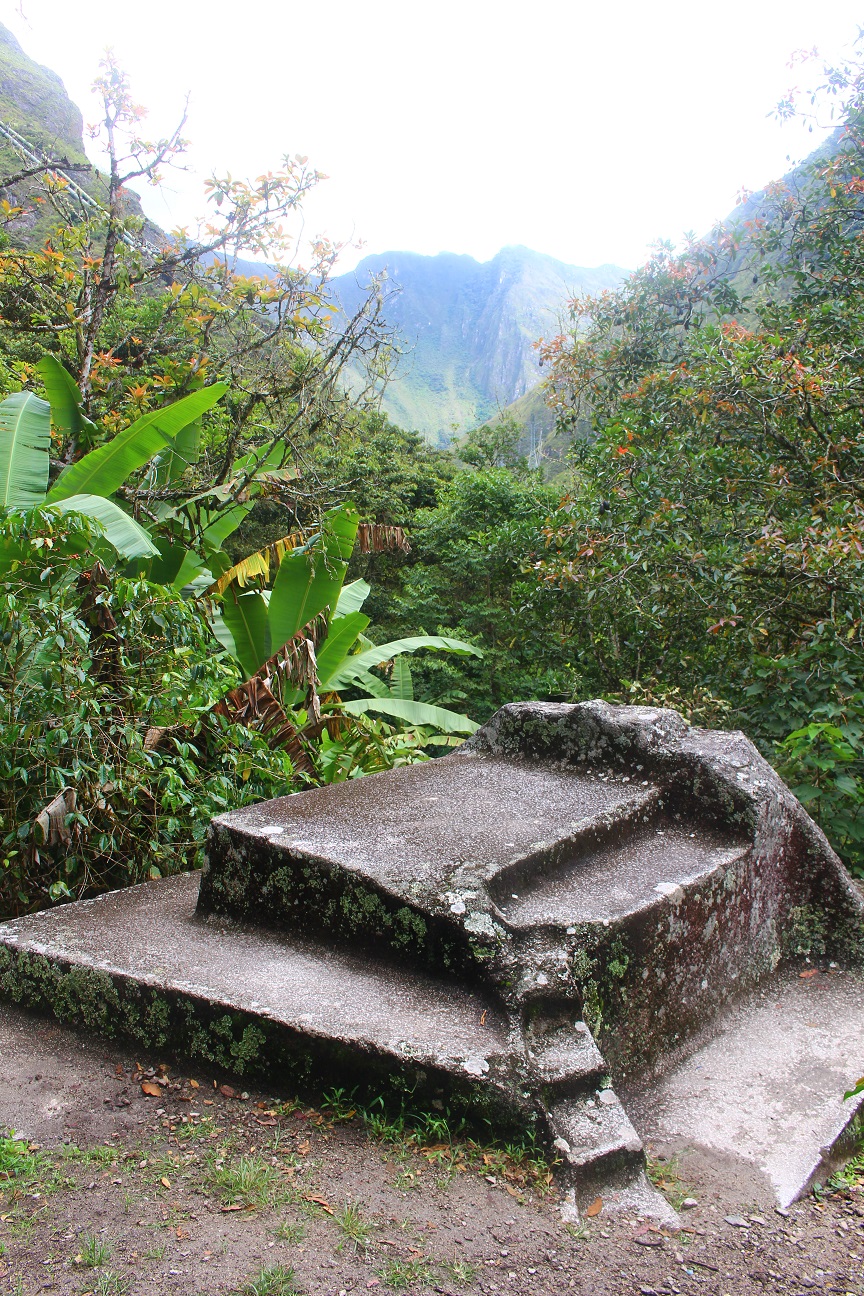
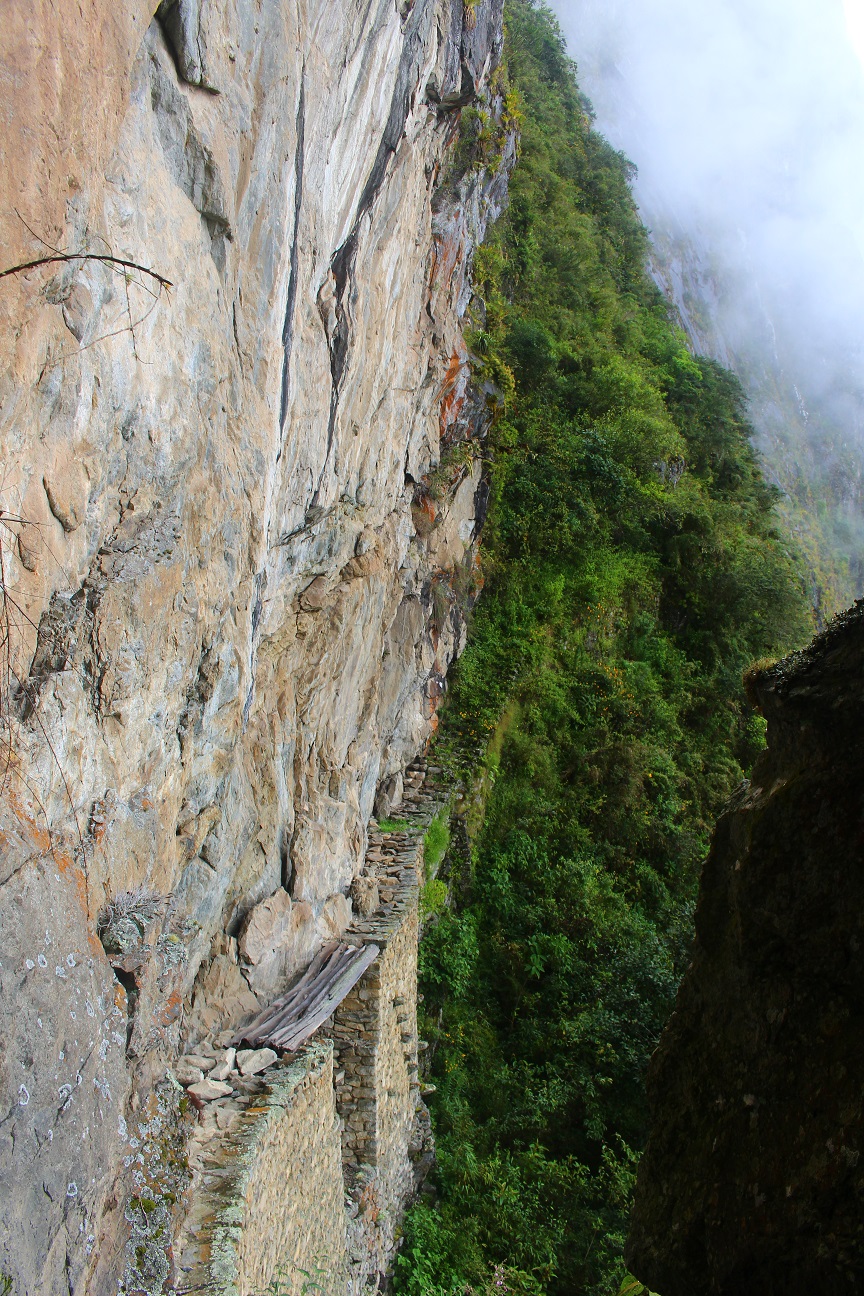
After the visit, I walked a bit more within the ruins, and I went to a point called The Inca Bridge. It was actually an escape path made by the Incas, in case the city was attacked. It goes along a cliff, really impressve! And there’s a small bridge in the middle of the cliff, although it’s blocked. Still, my vertigo and myself were not reassured 🙂
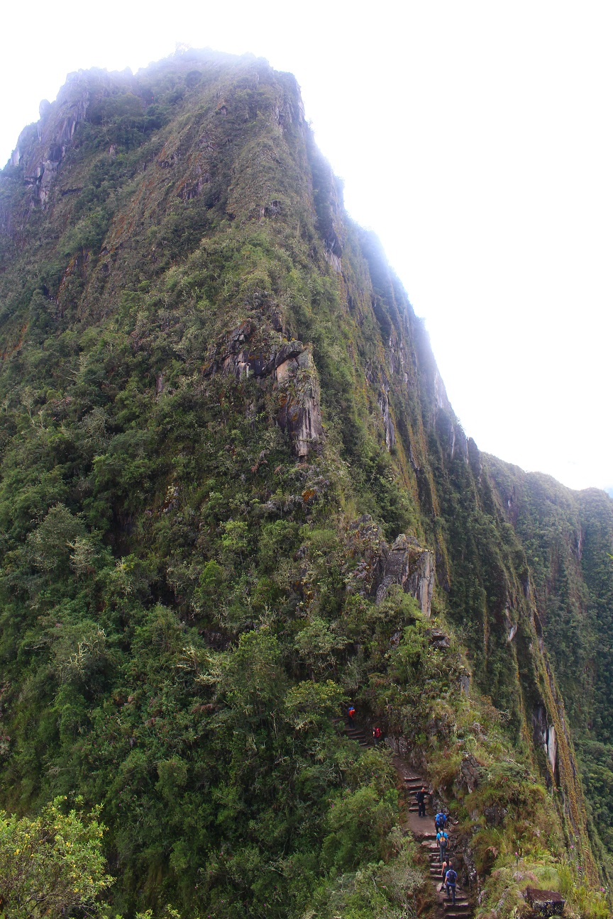
I also had a pass to walk up the Huayna Picchu mountain, the famous mountain on the site, at more than 2700m high. The hike up there was again mostly stairs, very steep, quite difficult after 4 days walking… Still I reached the top and had a pretty nice view on the Machu Picchu city 🙂
In the Inca legend, the Snake represents the past and the knowledge, the Puma represents the present and the strength and the Condor represents the future and the messenger. Cusco was originally built in the shape of a puma, and it is told that Machu Picchu was built in the shape of a Condor, as it was the city of the future.
Apparently it can be seen from the top of Huayna Picchu, I have to admit that I don’t really see it though 🙂

After the visit of Machu Picchu, I eventually went down and took a train to go back to Cusco.
I spent one more night there and the next day I took a bus to go to Nazca, see the famous mysterious Nazca lines 🙂
4 thoughts on “Salkantay Trek to Machu Picchu”
Dear Fred
Many thanks for the very interesting reports.
I wish you all the best on your further way.
Willi
Thanks Willi!
Glad you like it 🙂 It was really beautiful!
All the best to you too!
Mucho Pikachu, another amazing report, keep going till you can, then let’s have a beer at Sat.
Thanks!
Sure we will!